
Explore the moors:
Cornwall’s best kept secret!
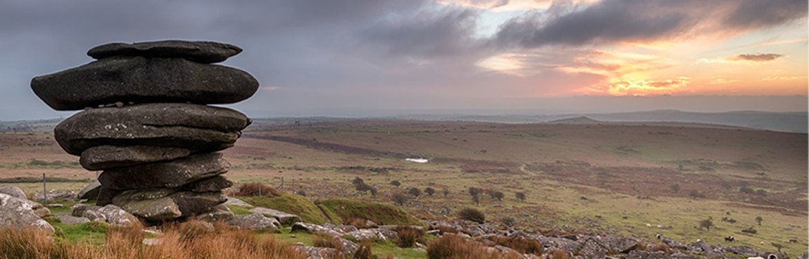
Bodmin Moor is one of Cornwall’s best kept secrets. It covers an area of 150 square miles and is a fantastic place for all ages and abilities to explore. It was once the heart of Cornwall’s tin mining industry and is steeped in history with ancient buildings, standing stones and medieval farms. It is also home to two of the highest peaks in Cornwall and the famous Copper Trail, a walking route which extends almost 60 miles around Bodmin Moor taking in the beautiful landscapes, lakes and ancient landmarks.
Here at Cornwall Services we have hand-picked a driving route which takes in the moors and some breathtaking scenery and includes some interesting places to visit on your way!
Directions:
TIME APPROXIMATELY 2 HOURS (NO STOPS)
From Cornwall Services turn right at the roundabout, go across the bridge
and then take the first exit onto the Old Coach Road; this joins the A389
Truro Road which continues towards Bodmin.
- Take a left towards Wadebridge about half a mile past Bodmin Nursery;
follow this road until you hit a T junction and turn left down the hill, crossing an old train line with a distinctive bump in the road. - Continue up the hill and take the right signposted the B3266 to Camelford.
From this point you are approaching Bodmin Moor. - Follow the B3266 all the way to Camelford then join the A39
towards Bude. - Take a right at the A395 towards the A30. At the A30, take the
exit marked Bodmin and head back towards Cornwall Services.

